To access this database join |
||

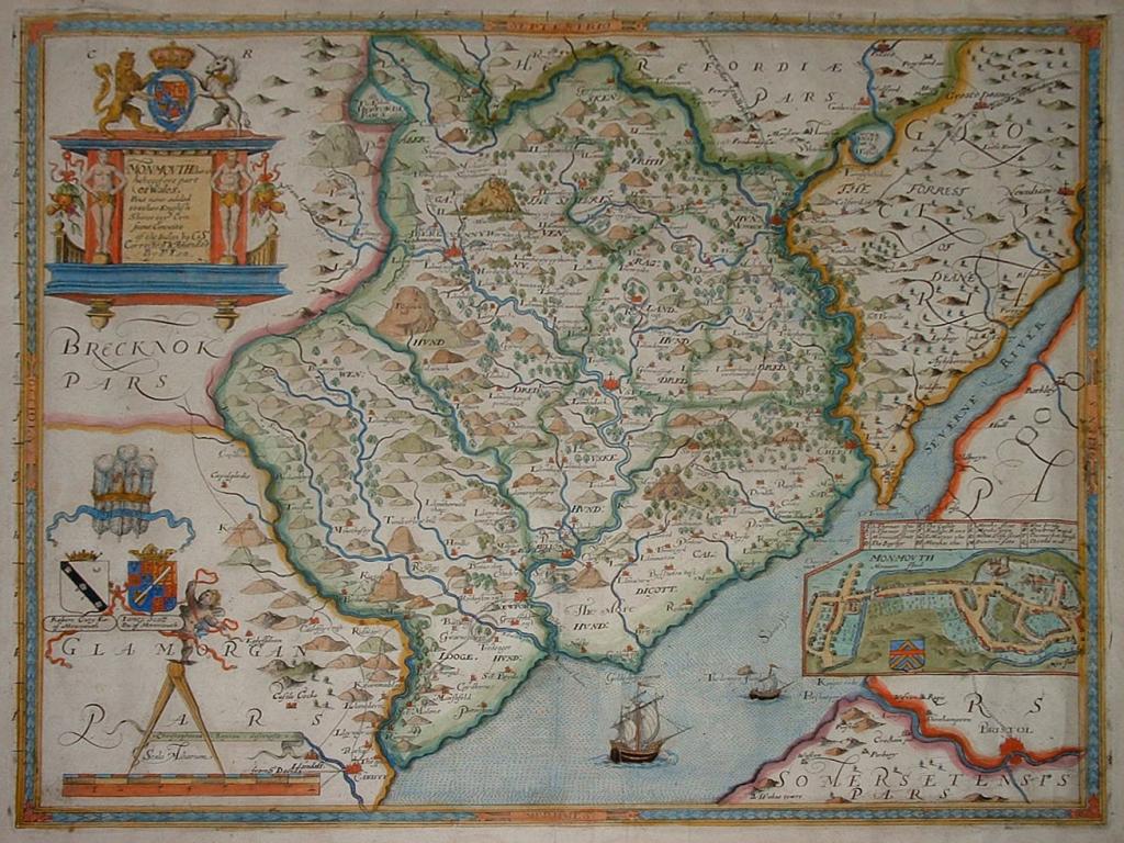
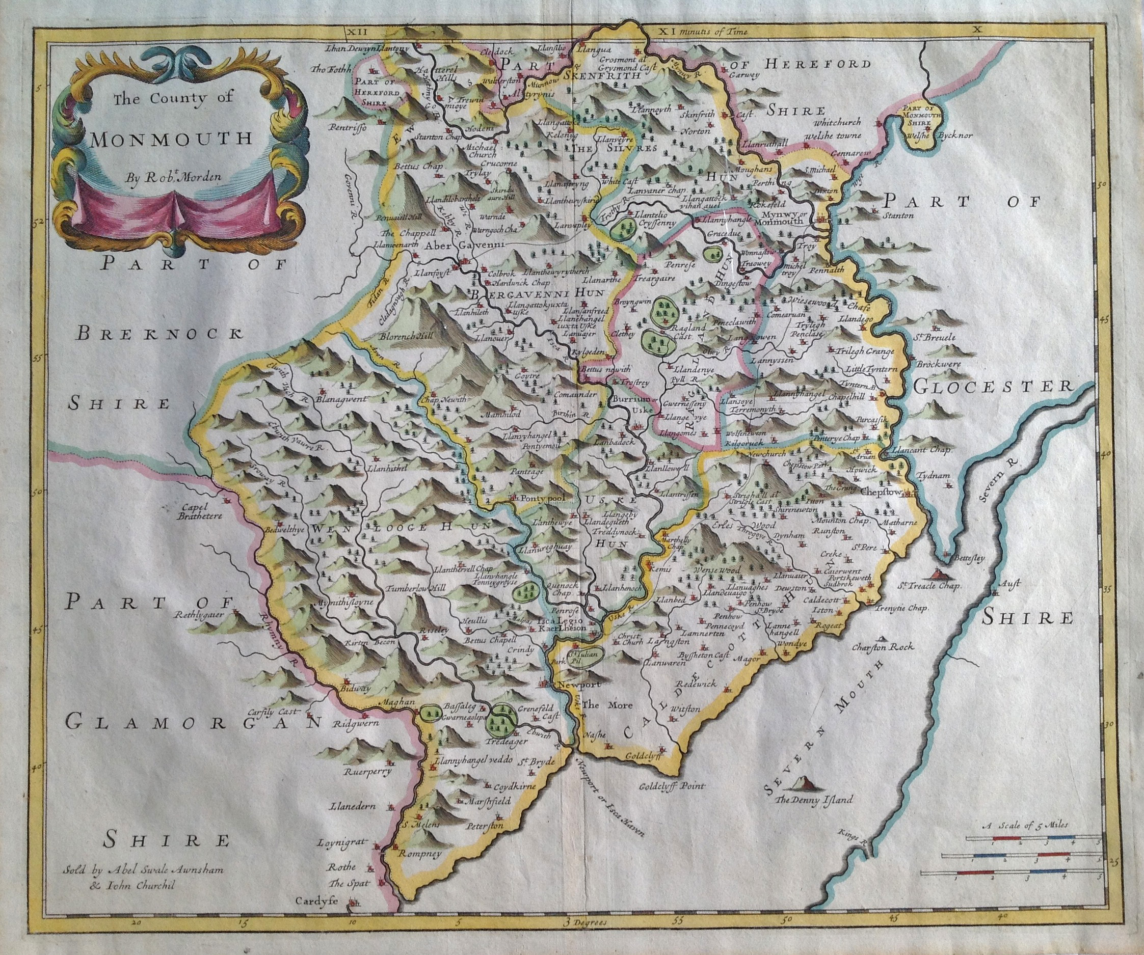
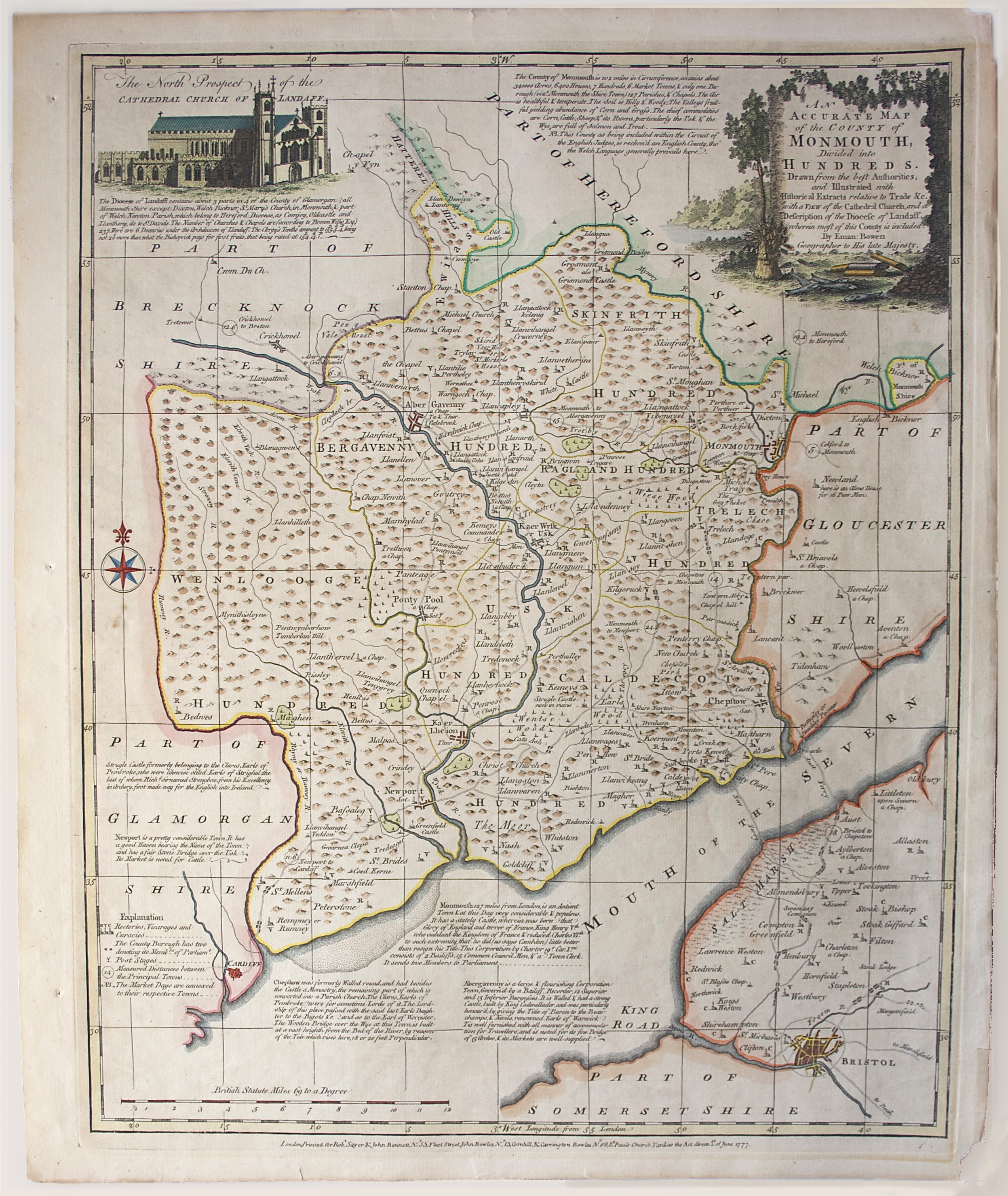
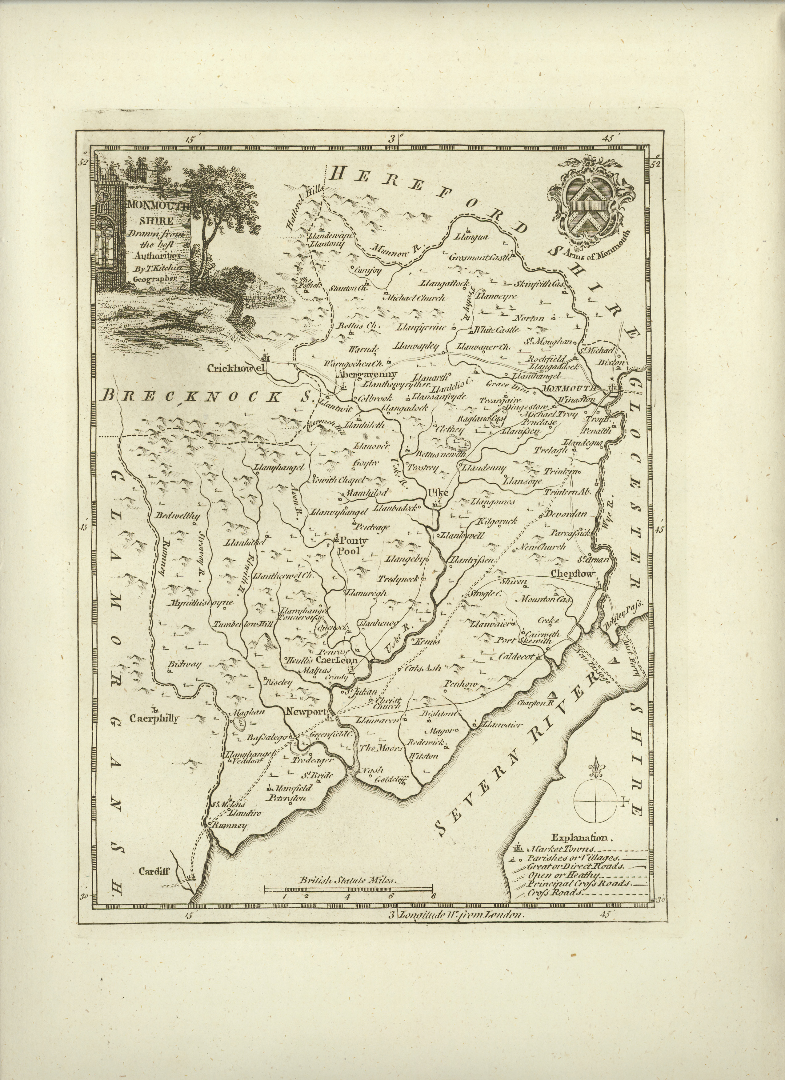
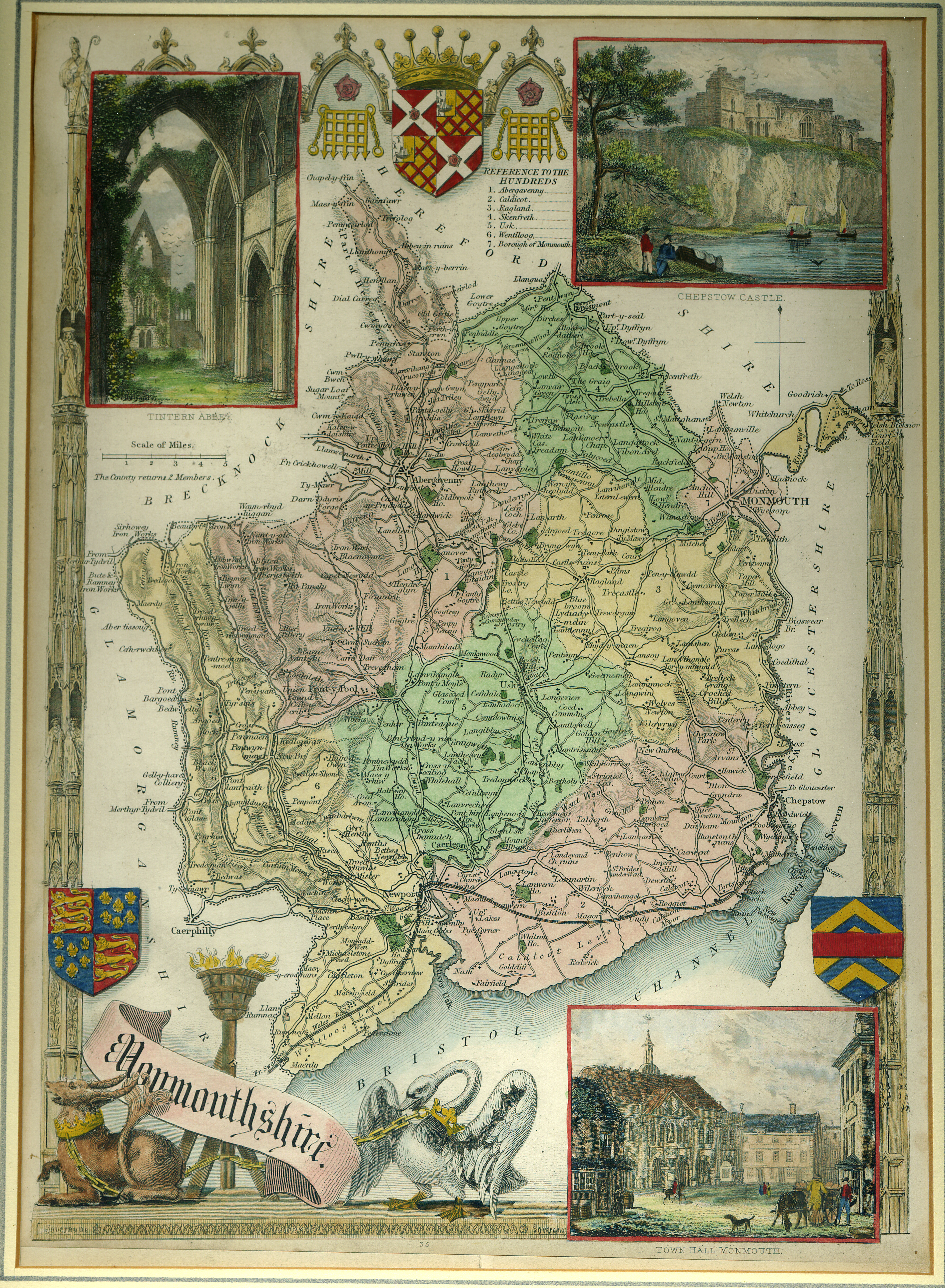
MONMOUTHSHIRE in 1699
The Traveller's Guide or, A Most Exact Description of the Roads of England, being Mr. Ogilby's Actual Survey, and Mensuration by the Wheel, of the Great Roads from London to all the the Considerable Cities and Towns in England and Wales, together with the Cross-Roads from one City or Eminent Town to another. Wherein is shewn the Distance from Place to Place, and plain Directions given to find the Way, by setting down every Town, Village, River, Brook, Bridge, Common, Forest, Wood, Copse, Heath, Moor, &c. that occur in Passing the Roads. And for the better Illustration thereof, there are added Tables, wherein the Names of the Places with their Distances are set down in a Column, in so plain a manner, that a mere Stranger may Travel all over England without any other Guide.
LONDON, Printed by T.Ilive for Abel Swall, and Sold by Tim Child at the White-Hart, and R. Knaplock at the Angel and Crown in St, Paul's Church-Yard; 1699.

The Abbreviations made use of in the Work, are these that follow:
Asc. for Ascent Br. for Bridge C. or Com. - Common Ch. for Church Corp. Corporation D. for Down Desc. - Descent F. for Furlong flv. or Riv. - River Fst. - Forest Gr. - Green H. - Heath K. - King M. - Mile Mt. - Market P.- Park Par. - Parish Parl. - Parliament R. - Road Riv. - River V. or Vill. - Village W. - Wood N. - North S. - South E. - East W. - West N.E. - North-East S.E. - South-East N.W. - North-West S.W. - South-West
The Continuation of the Road from LONDON to St. DAVID'S, in Pembrokeshire PART II.
The Road from MONMOUTH to LLANBEDER, in Cardiganshire, South Wales.
A transcribed Extract from the above Route
Monmouth to Brecknock Town:
I. The Point of Bearing N.W. by W.; II. The Direct Horizontal Distance 61M.; III. The Vulgar Computation 48M.; IV. The Dimensuration 68'4.
Leaving Monmouth. 4'F. cross Monnow flv. at 2'3 pass thro' Rockfield-V. and at 4'2 thro' Part of Llangadock: Whence an enclos'd Way over some Hills and Wooden-Brs. and Brooks, by Llanihangle-Estr'aglewis-Ch. 4.F. on the Left, leads at 7'2 thro' Landilo-Crusseny a discontinu'd Village with an Inn.
Hence a direct Way to Llanvapley at 10'4 descending a Hill and crossing Trothy flv. over a Stone Br. Then omitting the forward Way on the Left to Usk, a straight road extends by Llanthewerytherch-Ch. on the Left, cross a Valley and over a small Desc. at 13'6 to Kevenbedager-Hill, and a Desc, of 8 Furlongs.
At 15M. cross Kenvey or Ge'veny flv. over Ponter-Cwyn-Br. to Abergaveny vulgo Aberfeny, formerly Gobannium, seated at the Confluence of the Riv. Usk and Geveny; a large and well-built Town, of about 500 Houses, Compris'd in 2 Parishes, viz. St. Mary's and St. John's, and 8 Wards, viz. High-Street, Crow-Street, Butcher-Row, and Rother-Street, within; Frog-More, Tider, Monk-Street and Mill-Street, without: it is well fortify'd with a Wall, and an Old Castle built by Cadwalader; and govern\d by a Bailiff, Recorder, 12 superior and 15 inferior Burgesses. Its Mts. on Tuesd. and Frid. are well stor'd, as also its 3 Fairs, viz. on May 3, Tuesd. after Trinity-Sunday, and September 14. It has several good Inns, and a large Br. of 15 Arches over Usk flv.
From Abergaveny cross Kebby-Brook, and at 17'1 Part of Llanwenarth; the Usk running by the Road on the Left: At 18'2 over a Stone-Br, and Brook, at 19'2 enter Brecknocksh. and 2F. farther, pass thro' Llangrenay-V. There over a Wooden Br. cross Grannay-flv. and 11 F. farther, Crecowel on the Usk, a small Town, Govern'd by a Bayliff and 2 Burgesses; It has a small Mt. on Mond. and 3 Fairs, viz. on May-Day, St. Thomas and St. Lawrence; containing about 100 Houses, with 1 indifferent Good Inn.
At 22'7 by several Houses on the Road, and over some Brooks leave, LlannihangleYcombdy-Ch. on the Right, and by other Houses on the Road, call'd Tretowre; 25'6 pass thro' Bwlch-V. on an Eminence. Whence a straight Way leads over four Rivulets, thro' Llansanfraid-V. at 27'4, Castro-V. at 28'5, and Llanhamich-V. at 30'2. Then cross 2 Brooks, and at 33'6 enter Brecknock, the Shire-Town of 5F. on the Road and as much transverse.
The Continuation of the Road from LONDON to St. DAVID'S, in Pembrokeshire PART III.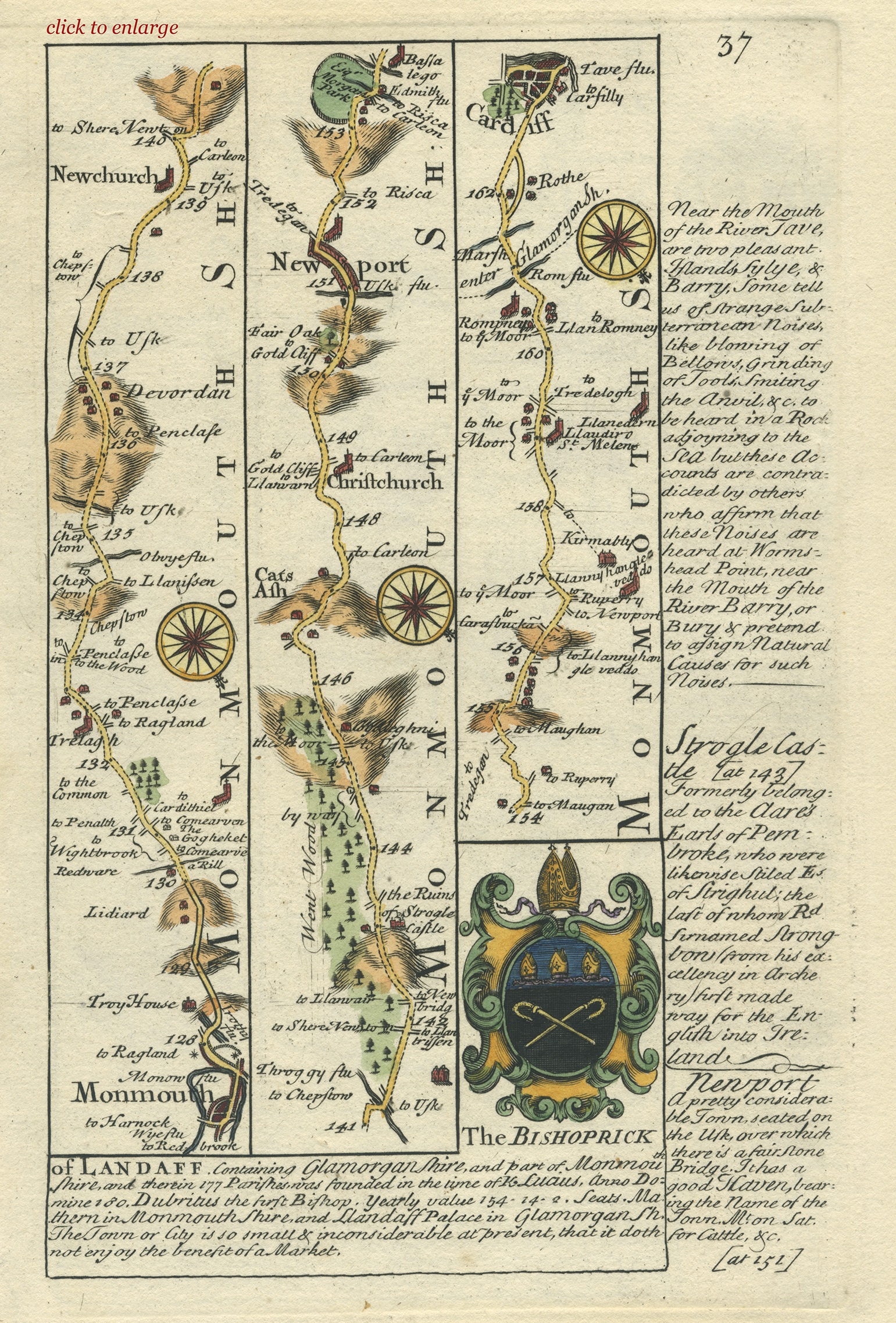
… In Part II - We brought you to Monmouth, a large and well-built Town on the Banks of the Wye flv., where it receives the Monow; enjoying several Privileges; sending one Burgess to Parl. &c. It had formerly a Wall and Castle now ruinous; but at present contains 2 Parishes, The Monk's Ch. and St. Thomas; 'Tis the Shire-Town, Govern'd by a Mayor, Recorder, and 15 Common-Council-Men, has a plentiful Mt. on Saturd. and 3 Fairs, viz. on Whitson-Tuesd.,. St Barthol. and St. Martin.
At the Entrance into the Town, cross the Wye, and the Monow on the W. over a stone-Br. of 2 Arches; Whence a kind of Suburbs of about 4F. to 127'7. 3/4 M. beyond which, over another Stone-Br. cross Trothy flv. leaving Troy House on the Left; Then 3 successive Asc. composing a considerable Hill; the R. proceeding partly on a Pav'd Cause-way, lead at 129'6 to Lediard-House on the Left, within 2F. of the Top of the said Eminence; 5 F. farther, by Red-waer another House on the Left; and 1/4 M. beyond that, to Gogheker on the Right, two or three Houses so call'd.
At 132'4 pass thro' Trelagh V. and 7F. farther (leaving the 2 acute Ways on the Left to Chepstow) down a Hill of above 1 M. At the Bottom, cross Olwye flv. falling into the Usk at Usk; then 4 F. beyond, descending gently and crossing a Brook, ascend a Hill of 1'4 near the Top of which, you come to Devordan a Village.
At 139'2 pass by New-Church close on the left; descending at 140 M for 6 F. and crossing Throggy flv. at 141 M. out 3 M. above its Influx into the Severn; Then ascending at 142 M. a Rise of 7 F. at the Top, leave the Ruins of Strogle-Castle on the Right, having Went-Wood for 4 M. on your Left: At 144'6, desc. 2 M. passing thro' Cats Ash in the Bottom: Whence ascending 4 F at 148'5, pass by Christ-Ch. on the Right, beyond which 3 repeated Desc. by Fair Oak on the left, lead to Newport of 6 F. on the S. W-side of Usk flv. which rising about the Confines of Brecknock and Carmarthensh. runs by Brecknock, Abergaveny, Usk and Carleon; and having received 13 other Riv. besides 2 below this Place, discharges itself into the Severn-Sea. The Town said to be rais'd out of the Ruins of Carleon, had formerly a strong Castle now Demolish'd; is as yet an indifferent large, and well frequented place; having a good Mkt. on Saturd. for Cattel, &c.
At 152'2 descend 7 F. leave Esq; Morgan's P. on the Left, opposite to a V. on the Right; cross Ebwith flv. which joyns the Usk just at its influx into the Severn; and pass by Bassalege-Ch. on the Right at 153'7. Then at 154'5 ascend 4 F. and the a Village, descend at 156 M. 2 F. leaving Llannihangle-veddo Ch. and Kirmably-House both on the Right about 3 F. distant.
At 159'1 pass thro' St. Melons, and Rompney 1 M. beyond, 2 Villages; then crossing Rompney flv. at 160'7, enter Glamorgansh. Whence by Rothe V. on the Right, at 162 M. 7 F. farther you come to Cardiff, call'd Caer Didd, i.e. Urbs Didii; by the Welsh, &c. seated on Tave flv. in a Rich and fertile Soil; a large, compact, and well-built. Town, having a Castle, Wall and 4 Gates. It contains 2 Parishes; is Govern'd by the Constable of the Castle, 12 Aldermen, 12 Burgesses, &c. keeps several Courts, and sends a Burgess to Parl. Here also are held Assizes and Sessions, a great Trade is managed especially with Bristol, and 2 Mts. are kept on Wednesd. and Saturdays.

A Topographical Dictionary of the United Kingdom
by Benjamin Pitts Capper
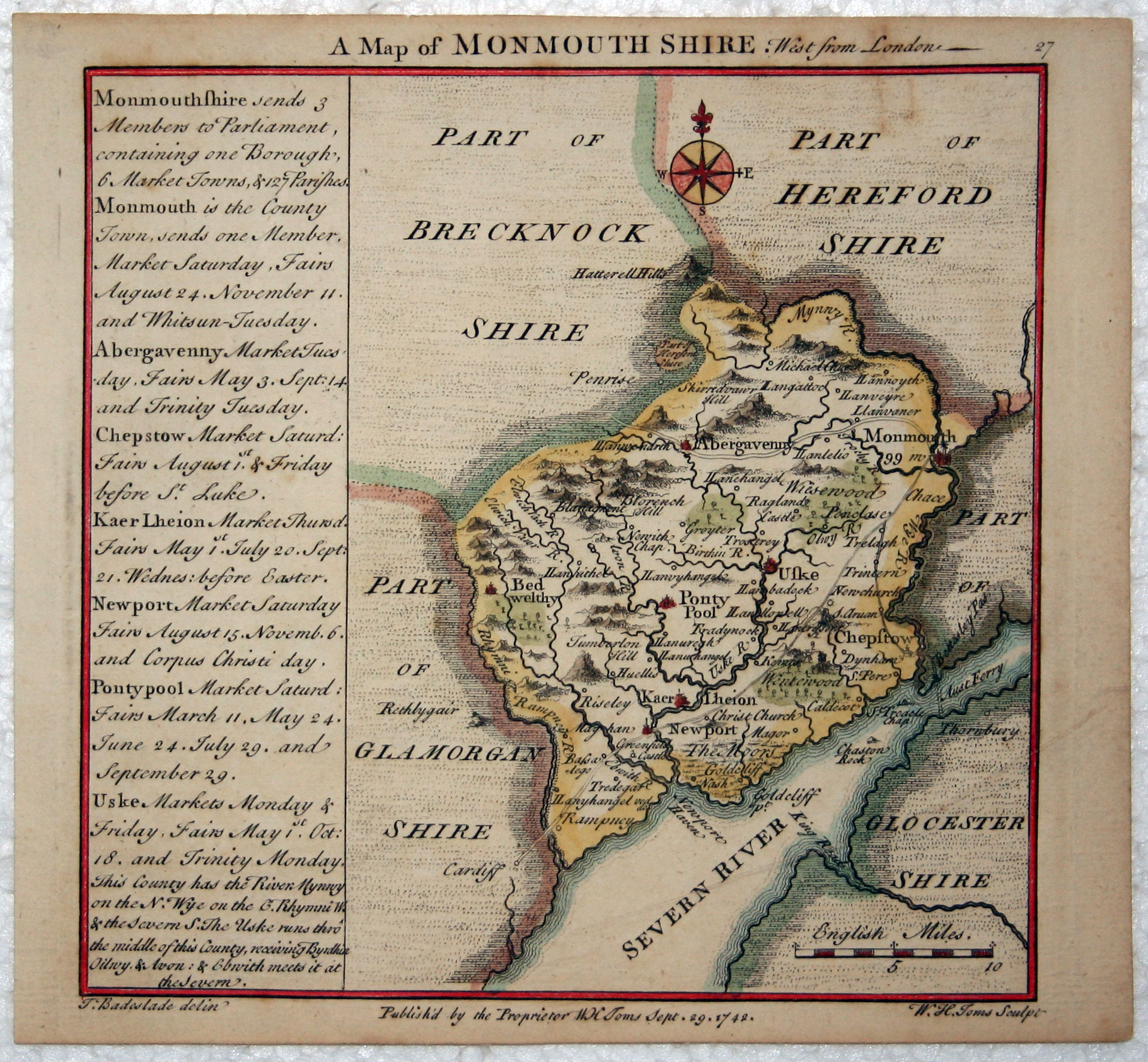
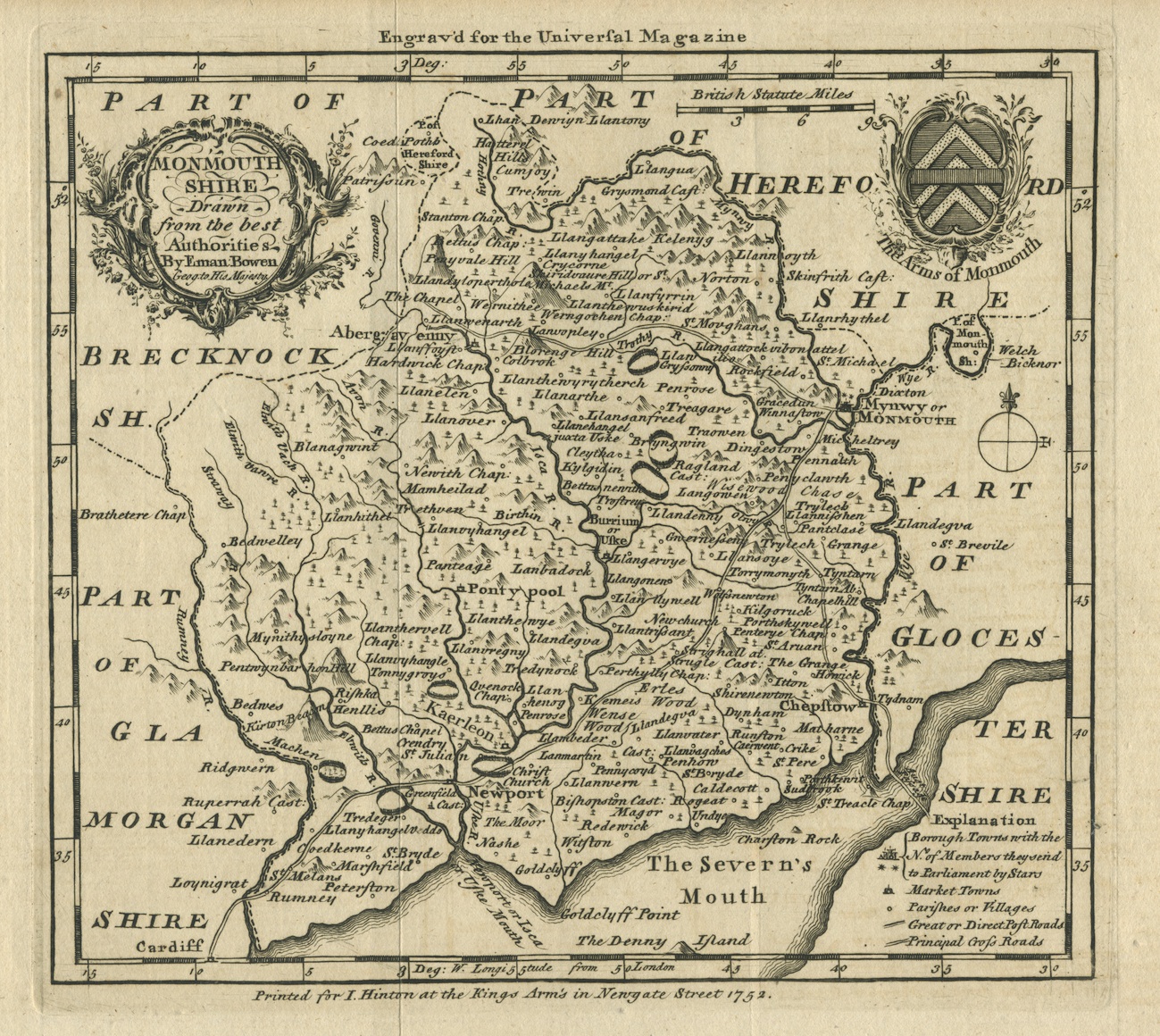
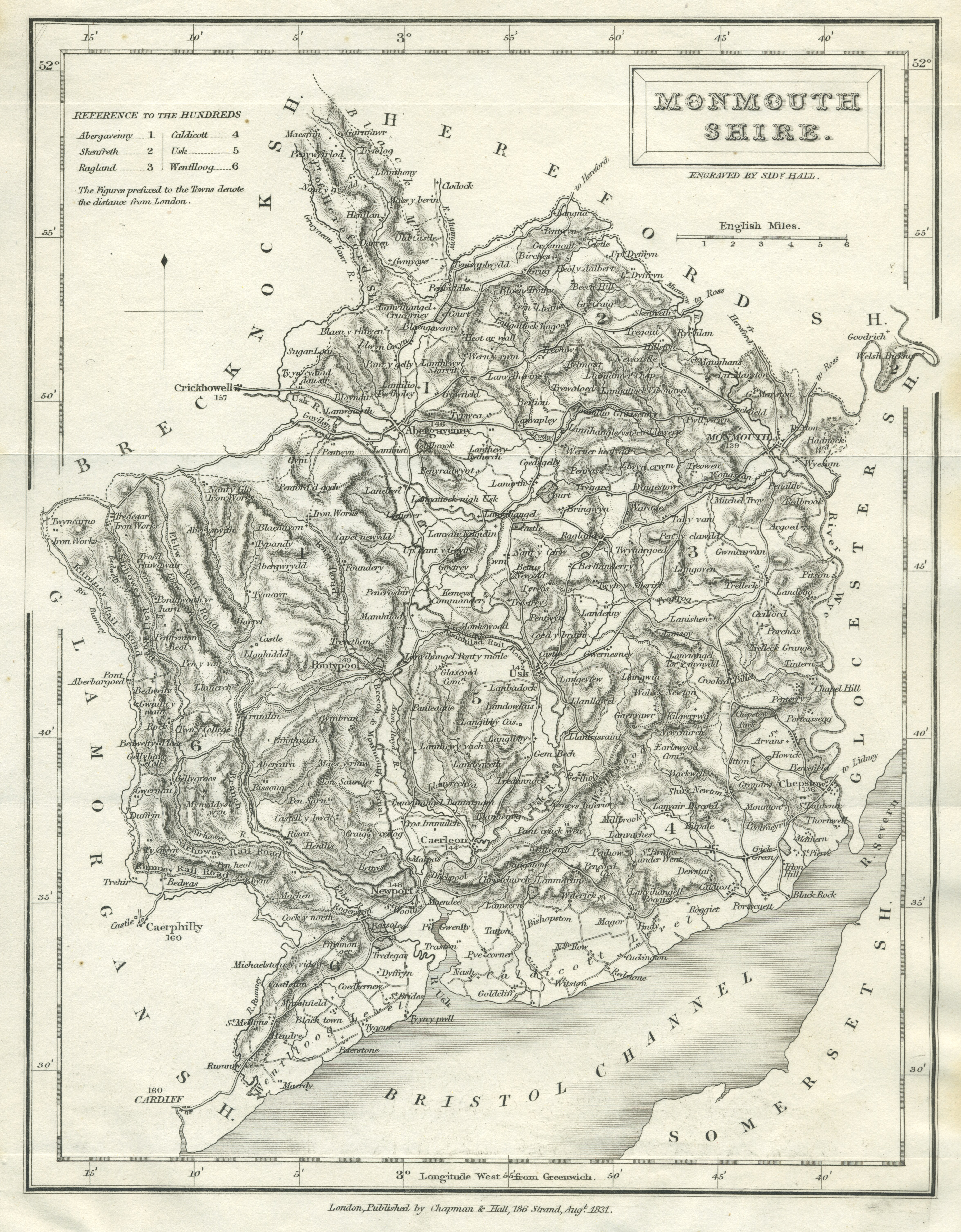
MONMOUTHSHIRE in 1808
A county of England, bounded on the north-west by Brecknockshire, on the north-east by Herefordshire, on the east by Gloucestershire, on the south by the Severn, and on the west by Glamorganshire. It is about 24 miles long and 20 broad, containing 340,000 acres of land, having about 100,000 acres arable, 215,500 acres in pasturage, and about 20,000 acres uncultivated, including woodlands.
It is divided into six hundreds, viz. Abergavenny, Caldicot, Ragland, Skenfreth, Usk and Wentloodge, containing one borough, Monmouth; six market towns, viz. Abergavenny, Caerleon, Chepstow, Newport, Pontypool and Usk, with 127 parishes, 8948 houses, inhabited by 45,582 persons, viz. 22,173 males, and 23,409 females, of whom 5540 were employed in trade and manufacture, and 12,871 in agriculture. 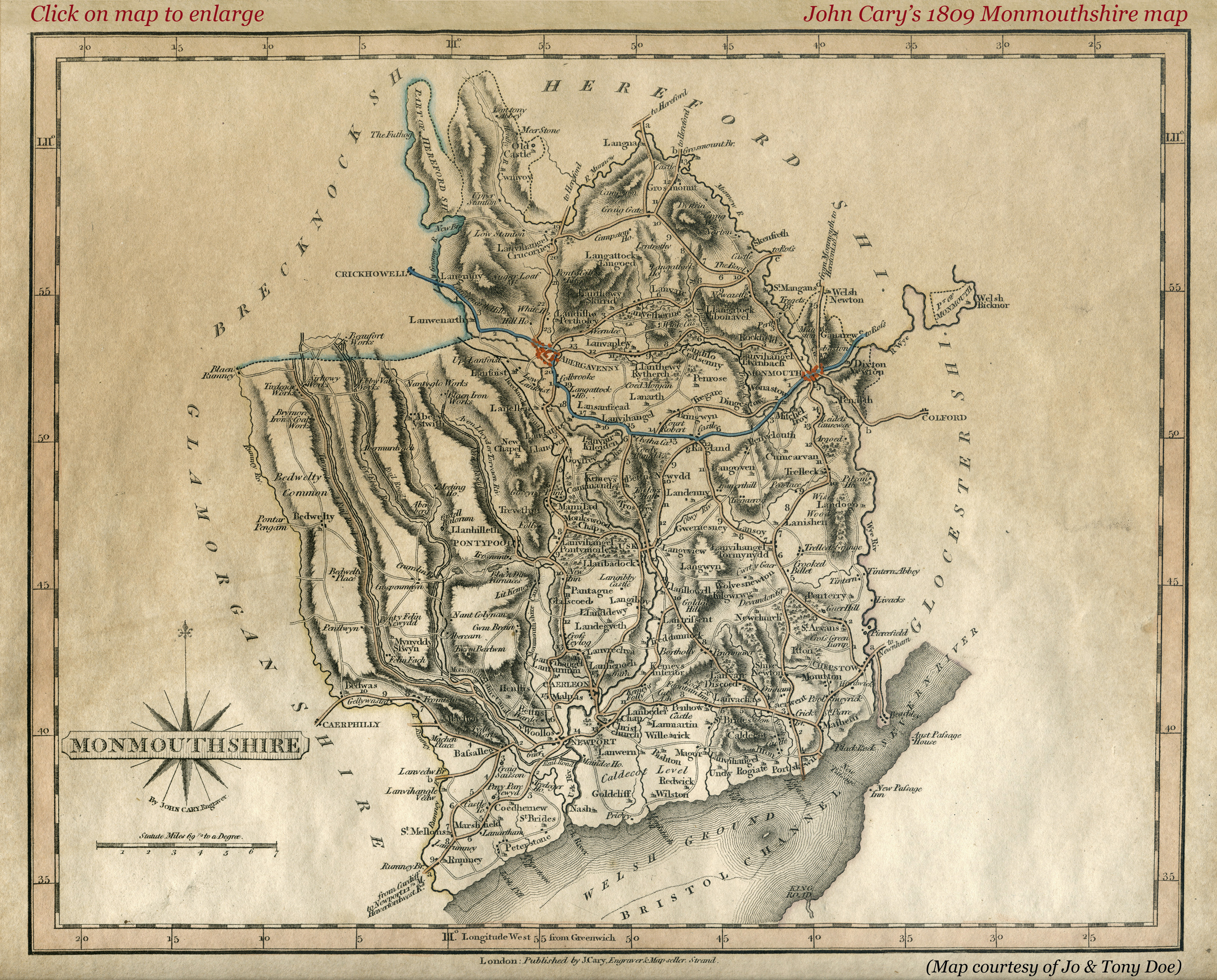
The amount of money raised under the poors rate in 1803 was £25,048 being at the rate of 7s.11.1/4d. in the pound. The total amount of property returned in 1806, as liable to the income-tax, was £374,057. The average scale of mortality for 10 years, appears to have been as 1 to 58 of the existing population.
Monmouthshire sends three members to parliament, viz. two for the county and one for the borough of Monmouth; it lies in the diocese of Llandaff and province of Canterbury. This was formerly reckoned on the the Welsh Counties, and from the name of its towns and villages, its mountainous appearance, and its situation beyond the river Wye, which seems to be a natural boundary between England and Wales, it certainly partakes of the character of the latter country.
Its principal rivers are the Usk, the Wye, and the Mynnow. The Usk divides the county into two portions, of which the eastern or largest is very fertile in corn and pasturage and well wooded; it abounds with limestone, which is burnt on the spot and makes excellent manure. The smaller western part is mountainous, and mostly unfavourable for cultivation, being principally devoted to the feeding of sheep. It has several long narrow valleys, watered by small streams which fall into the Bristol Channel. All the rivers above mentioned abound with fish, particularly salmon and trout. The river Avon empties itself into the Usk at Caerleon, and turns several mills for the working of iron plates, in a manufactory of japanned ware (once very considerable) at Pontypool on its banks. The principal manufacture of the county is flannels.
The air in general is very temperate and healthy, and the soil tolerably fruitful. The language used by the lower class is Welsh, but the English is daily growing more familiar. At the Roman invasion it was part of the territory of the Silures, and was then considered as a part of Wales, and by the natives called Gwent, until the reign of Charles II, when it was taken into the Oxford Circuit, and deemed a county of England.

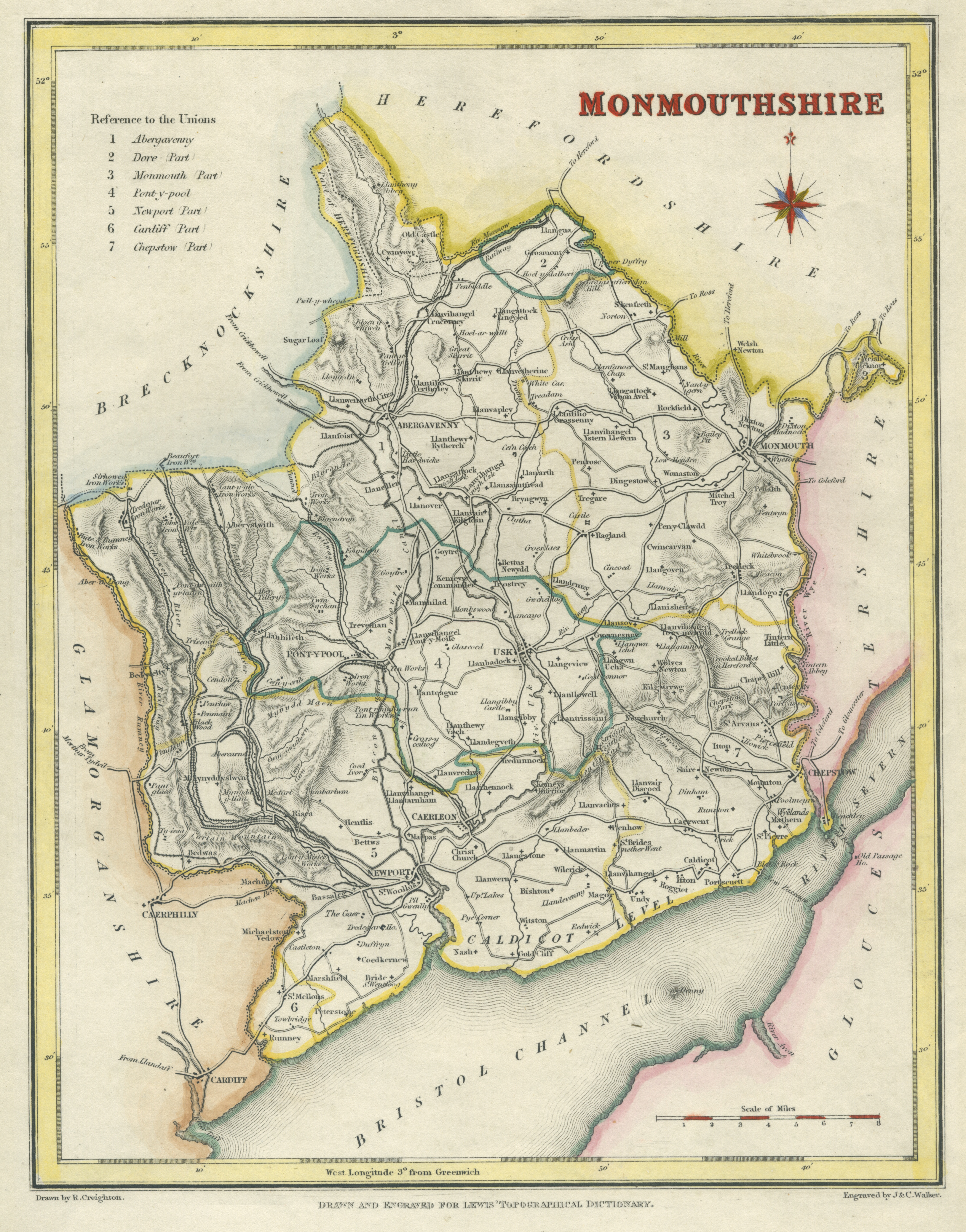
The National Gazetteer : a Topographical Dictionary of the British Islands (1868)
MONMOUTHSHIRE in 1868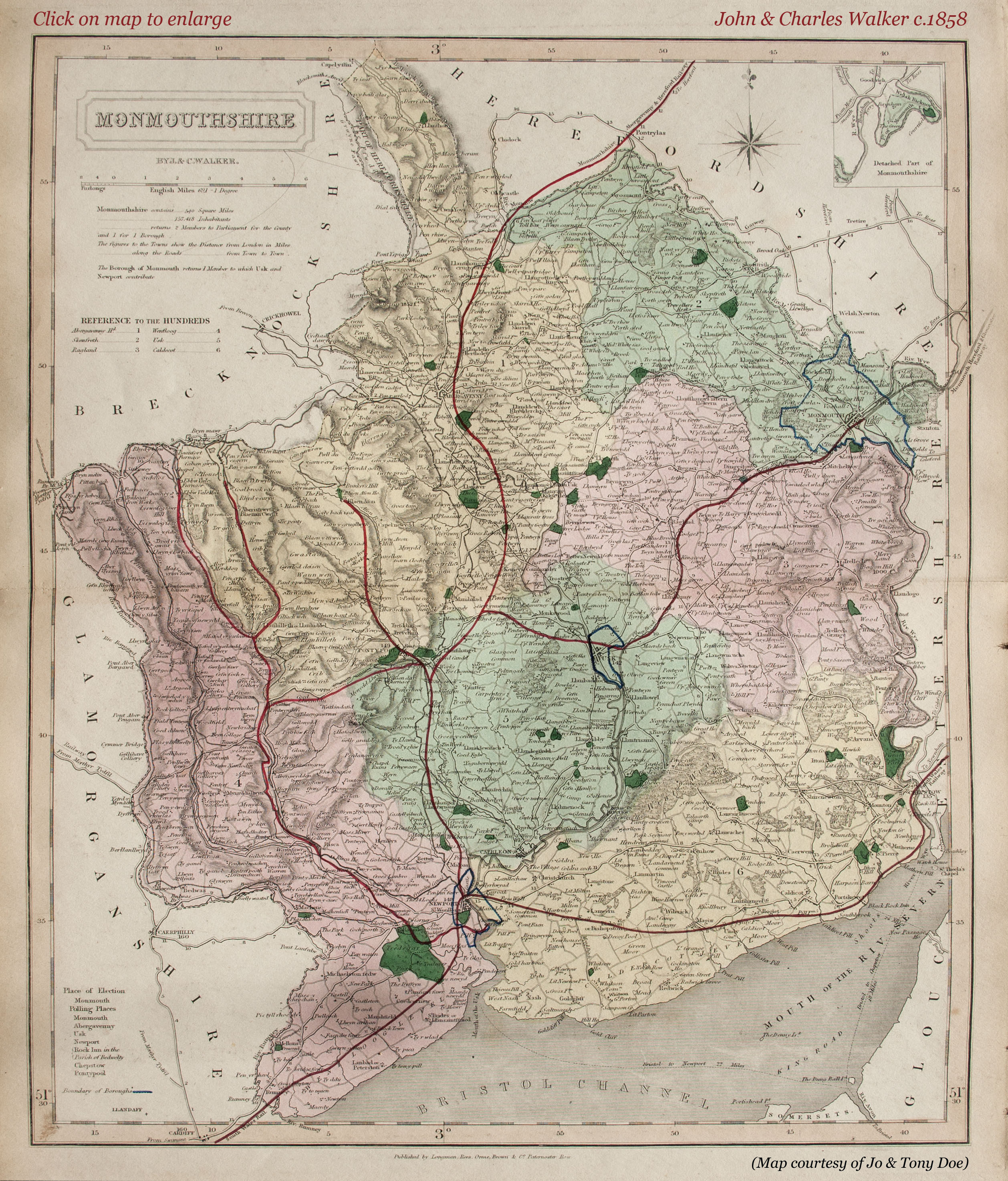
In an agricultural point of view Monmouthshire may be divided into three districts, of which the first comprises the southern portion, consisting partly of large tracts of moor and marsh land, including the greater part of the hundreds of Wentllooge and Caldicott, where sea walls have been constructed at vast expense to prevent the sea from overflowing the extensive marshes originally drained by the monks of Goldcliff. The second district comprises the eastern portion of the county, including the valleys of the Severn, Wye, and Usk, which possess such natural advantages and fertility of soil that the whole country wears the appearance of a garden; and the third district comprises the mountainous region towards the west, where the soil upon the hills is generally shallow, and occasionally entirely sterile, affording scanty pasture to the flocks of small sheep which number about 170,000, yielding 2,000 wool packs.
The arable land lies mostly towards the east, and rich loam, mixed with peat, is the soil of the level lands along the Newe. The large Hereford and other cattle are used for labour. Barley and oats form the principal crops in the north and north-west, but in the more sheltered valleys of the Usk and Wye, wheat, potatoes, peas, beans, and turnips are largely grown. Apple orchards are plentiful in favoured situations, especially adjoining the Herefordshire border, and oak coppice abounds. Besides smaller forests of oak and ash, Wentwood Forest alone comprises 2,170 acres, and was formerly much larger when it took in the castles of Dinham, Lanvaches, Llanvair, Penhow, Pencoed, and Striguil, or Troggy. There are also 5,000 acres of common at Greensnore.
The climate in the southern part of the county is very temperate and salubrious, but in the north. and west among the hills it is colder and more damp on account of the greater quantity of rain that falls, the passing clouds from the Channel being attracted by the hills. The estates are in general large, but the farms of moderate size, varying from 100 to 300 acres of arable, mostly held by the farmers at will.
The county is traversed for about 23 miles by the South Wales line of railway, which, passing by Chepstow, Portscuett, Newport, and Rumney, follows the bank of the Severn to Cardiff, and communicates by steam ferry across the estuary of the Severn with Bristol. A line of railway has also been recently constructed along the bank of the Monmouthshire canal, from Newport past Pontypool and Abergavenny to Hereford. These two main lines are connected by numerous branch lines with the Vale of Neath railway, besides local branches to most of the large manufacturing villages, and tramways to the coal and iron mines. The turnpike roads are numerous and well kept, traversing the county in various directions. The principal lines from Monmouth are through Llantillio, Cresseny, Abergavenny, and Tredegar, to Merthyr Tydfil in Brecknockshire, 25 miles; another line through Ragland, Usk, and Caerleon, to Newport, 21 miles, with a fork from Usk to Pontypool and over the hills to Caerphilly, 32 miles; a third line of road leads by Trellech and Tintern Abbey, down the Wye to Wyndcliff, and so to Chepstow, 13 miles; a fourth by St. Weonards up the valley of the Wye to Whitchurch, and so to Ross, 10 miles; a fifth by St. Weonards to Hereford, 18 miles; and a sixth line of road from Monmouth through the Forest of Dean to Gloucester, 25 miles.
Besides these there are numerous branch roads connecting most of the important villages and hamlets, which have recently been springing up in every part of the country, owing to the vast development of the mining and manufacturing interest in this county, the mineral wealth of which seems to be almost inexhaustible. Besides the malleable iron, tin-plate, and smelting works mentioned above, a considerable manufacturing industry is maintained by the weaving of flannel, coarse cloths, woollen stockings, and caps, for which last manufacture Monmouthshire was formerly celebrated, though it has now become almost obsolete. It was enacted in the 13th Elizabeth, C19th, that Monmouth caps should be worn by all persons, except a few of worship and quality, on Sabbaths and holydays, on the pain of forfeiting 10 groats for the omission, and Fuller says that in his time "thousands of people were maintained thereby;" but this trade was subsequently removed to Bewdley, in Worcestershire. Near the town of Monmouth there are also several paper and corn mills.
The population in 1851 was 157,418, and in 1861 was 174,633, and the number of inhabited houses in 1861 was 33,077, besides 2,021 uninhabited, and 226 building.
The general aspect of the county is diversified, some portions being hilly and even mountainous, while the valleys are luxuriantly rich, and the slopes of the hills chequered with woods and pastures.—The geological formation of the county belongs to the carboniferous series of rocks forming part of the great South Wales coal basin, superimposed on carboniferous limestone, which shows itself in the hills to the E. and S.E., along the Wye and near Wentwood. In the neighbourhood of Pontypool Old Red sandstone prevails, while about Usk, and at various points on the border, strips of silurian and slaty rocks crop up.
The most important mineral productions are—coal, which is of the variety called anthracite, and occurs in strata from 3 to 9 feet thick; ironstone, which yields 30 per cent, of metal, and is extensively wrought both into pig and tar iron; lead ore is found, and limestone of the finest kind is obtained in almost every part of the county. There are several quarries of breccia for millstones, also mica slate and other valuable kinds of stone. The extensive coal, iron, tin, and other works, which have chiefly sprung into operation since the latter part of the last century, now furnish employment to as many people as are engaged in agriculture or in trade. The chief works are Myuyddyslwyn, Nantyglo, and Beaufort coal mines, which employ near 5,500 hands; Pontypool and Caerleon blasting tin and iron works, which above 2,000 ; Aberyschan, Blaenavon and Clydach, Pentwyan and Galynos, Rumney or Rhymney, Sirhowy and Ebbwyvale, and Tredegar iron works, which together yield above 2,000,000 tons of iron yearly. In addition to the manufacture of iron there are at Caerleon, Pan-teague, and Rogerstone extensive tin-plate works.
All transcriptions on this page by J.Doe for MonGenes.org
|
|
|
|
|
|
|
|
|
|

Click on a map to enlarge it. Maps courtesy of: mapsperhaps.com (1) Antiquemaps.com (3) From Old Books.org (6) Jo & Tony Doe (2) (4) (5) (7) (8) (9) & (10)
All images unless otherwise credited are © MonGenes and may not be reproduced without permission
© MonGenes 2013
website created by  Doe graphic design

The County of Monmouthshire

![]()
![]()